
Rick McBee's Writings
Explore the magic of new ideas and books to read as well as see what books I have written, my favorite photos, my opinions on may subjects, including Science, Africa, the Caribbean, the Civil War, my Book Reviews, and Much More!
Hiking on Mt. Hood’s Trails

Another Beautiful day in Oregon and time to have another hike on the lower slopes of Mt. Hood. You can see where it was that we hiked on the link below. About 8 miles of generally easy walking with a stop for lunch. The Link will take you to Google Earth which I presume you have: You will see our pathway for the 8 mile hike.
Google Earth Map with hike and location points
So having seen the map, here is a short series of pictures and videos of the hike which started at about 9:30 AM near the Umbrella Falls trailhead. Note in the pictures we are not wearing our masks, but we do put them on whenever we meet others on the trail and also when we are ourselves stopping and yakking, eating lunch, and are close to one another. I wouldn’t want you to think that the old Biology Teacher/ Parasitologist/ World traveler/ Son of a renowned Microbiologist …. didn’t adhere to proper COVID 19 protocols during this pandemic time.
So what did we see? An amazingly Gnarly Old Tree! Watch the video below!
We ford a small stream and then pass a rushing Waterfall in Heather Canyon that leads down into Clark Creek. This area is a double black diamond area for skiers at Mount Hood Meadows Ski lift.
Then after hiking several hours we climbed out of the desert – like N. Side of Heather Canyon with Mt. Hood in the background. 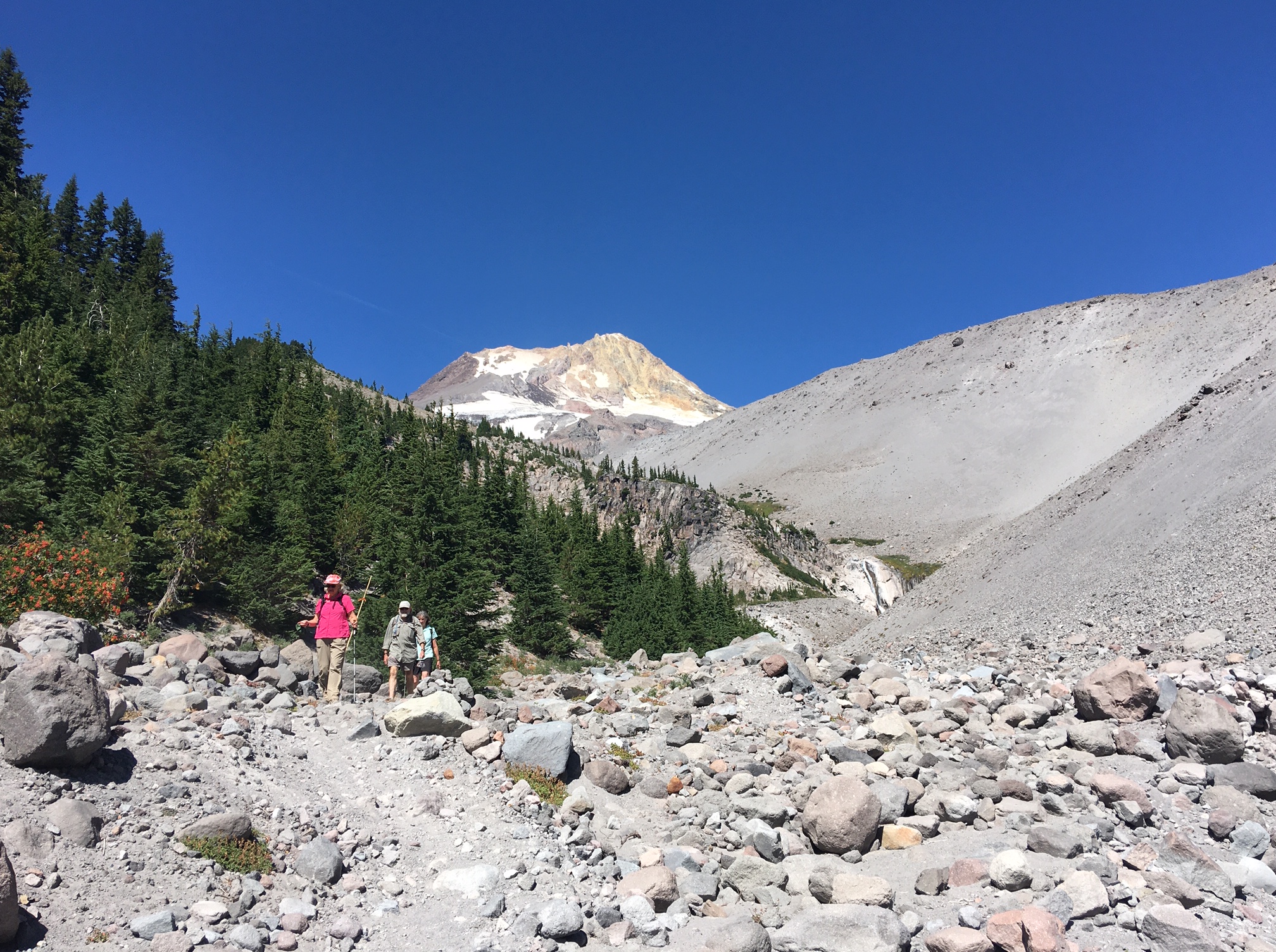
into the trees where we finally stop for lunch. 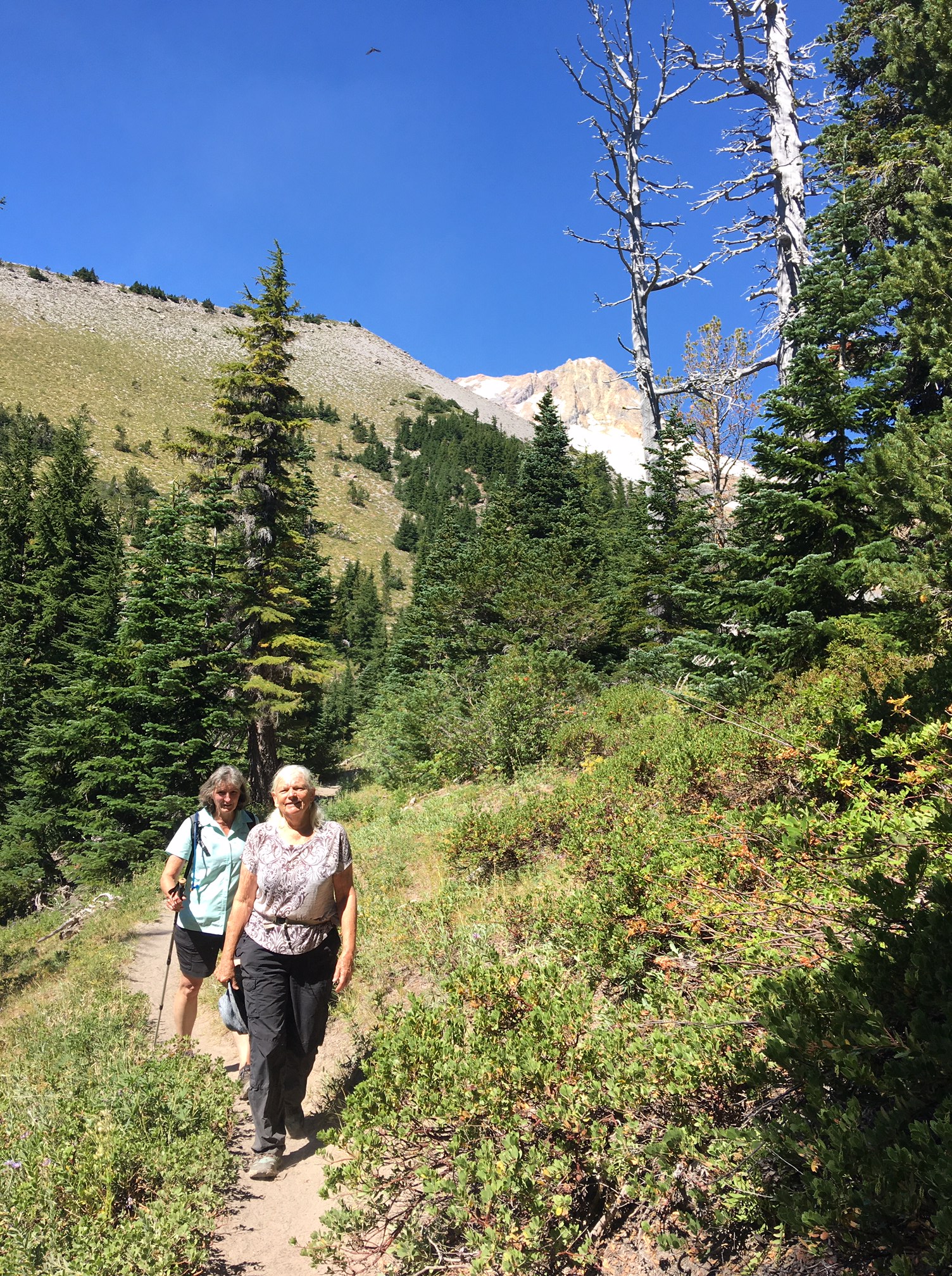
With More views of Mt. Hood. 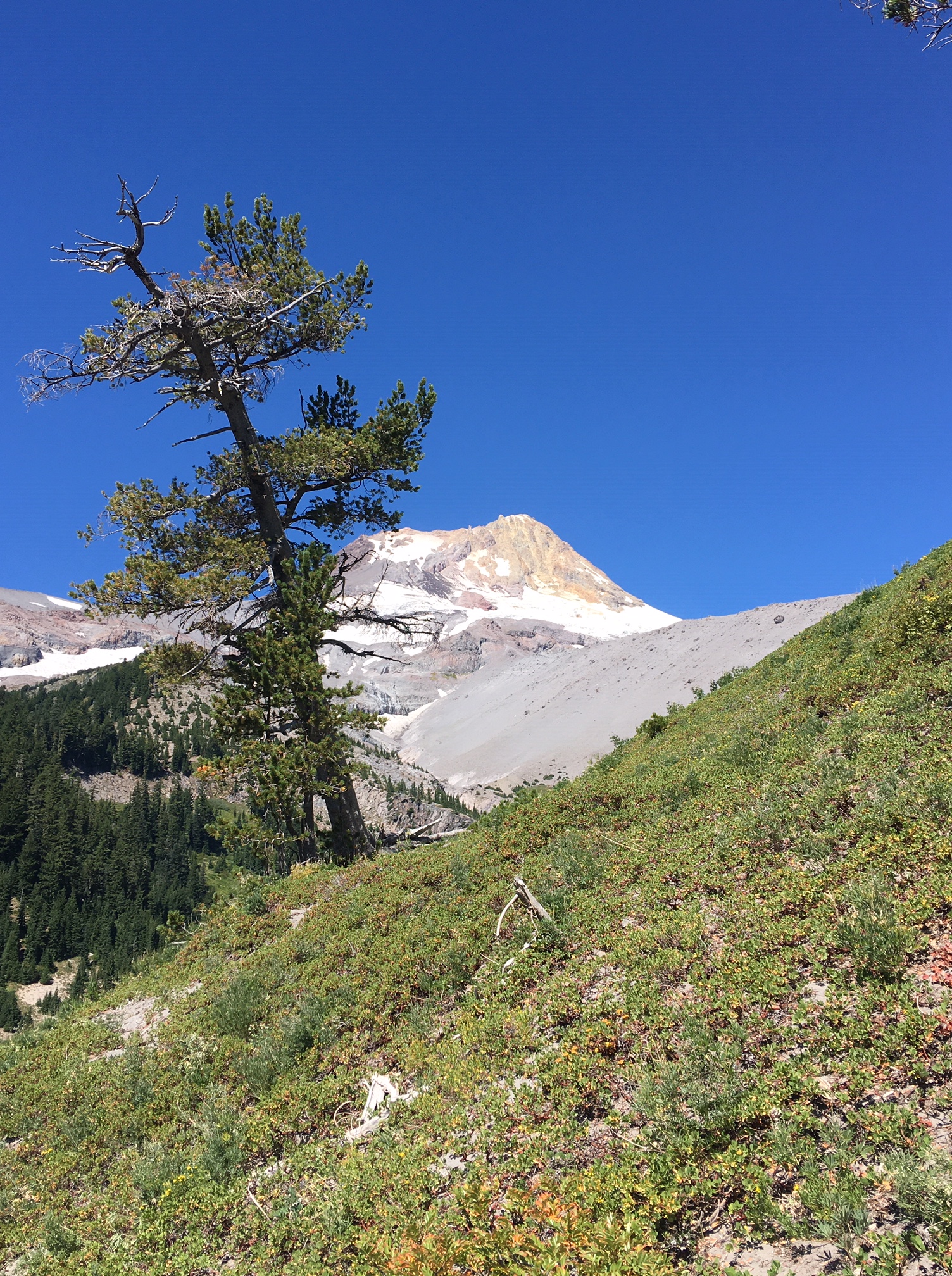
Once over the top of the ridge we drop down – down towards Newton Creek which comes out of one of the rapidly shrinking Glaciers on Mt. Hood. Then look down a terrifying slope from some over-hanging rocks some 200 yards into the depths of Newton Creek Canyon and across to Gnarl Ridge – another hike for another day.
Finally, after dropping into the canyon we reach the final view looking back up Newton Creek. Here’s my wife Jill: 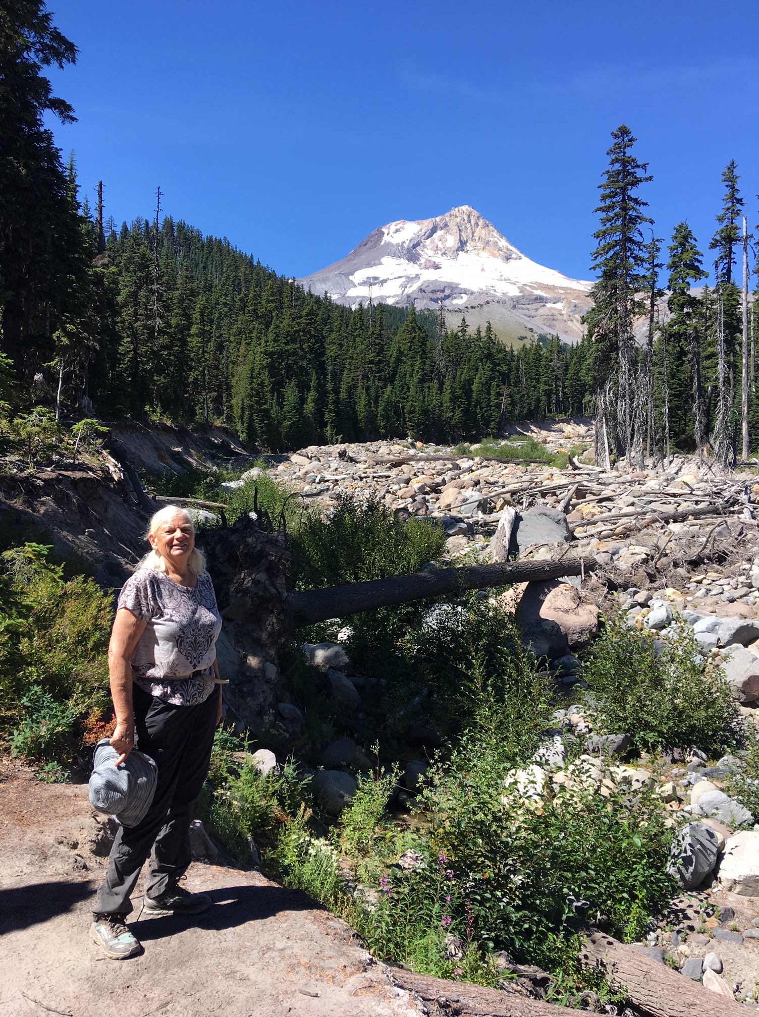
and me!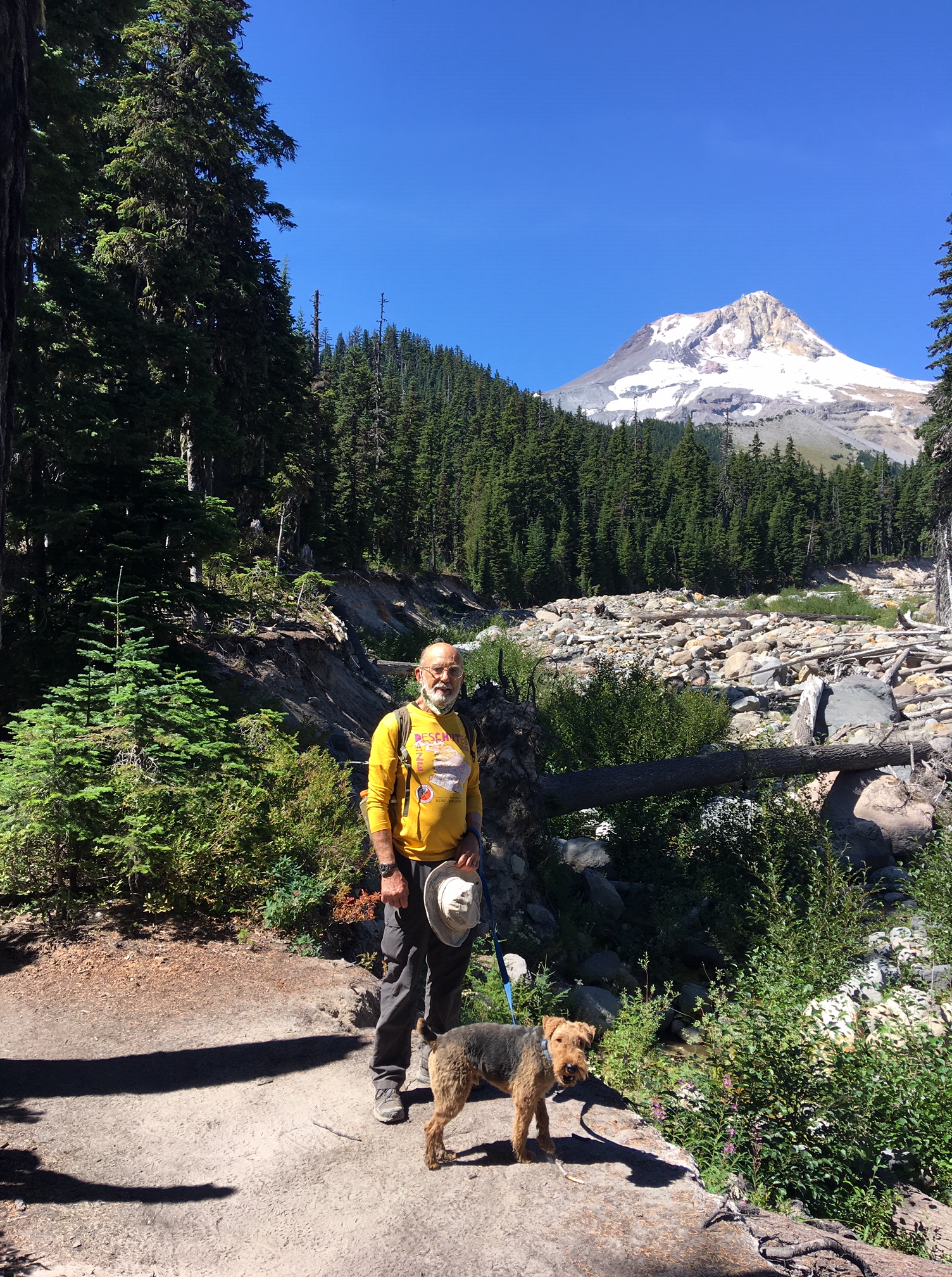
We then re-enter the deeper forest for another two miles to reach Hood River Meadows parking area and the trailhead leading to Elk Meadows and Gnarl Ridge that on another day will lgive us another 8 miles or so of good hiking.
Enjoy yourselves and stay safe. Make sure you get out and vote in November!
One Comment on “Hiking on Mt. Hood’s Trails”
Hope you enjoyed my Blog. I would like to hear from you
South Africa Book Group on Goodreads
.gr_grid_container { /* customize grid container div here. eg: width: 500px; */ } .gr_grid_book_container { /* customize book cover container div here */ float: left; width: 39px; height: 60px; padding: 0px 0px; overflow: hidden; }
 1557 members
This is a book club for all South Africans who love reading! We also have members from other coun...
Books we've read


View this group on Goodreads »
Share book reviews and ratings with South African Book Lovers, and even join a book club on Goodreads.

Thanks Rick for the great vicarious hike on Hood!! It was obviously a glorious day to be out! Hope to see you when we can!
LikeLiked by 1 person